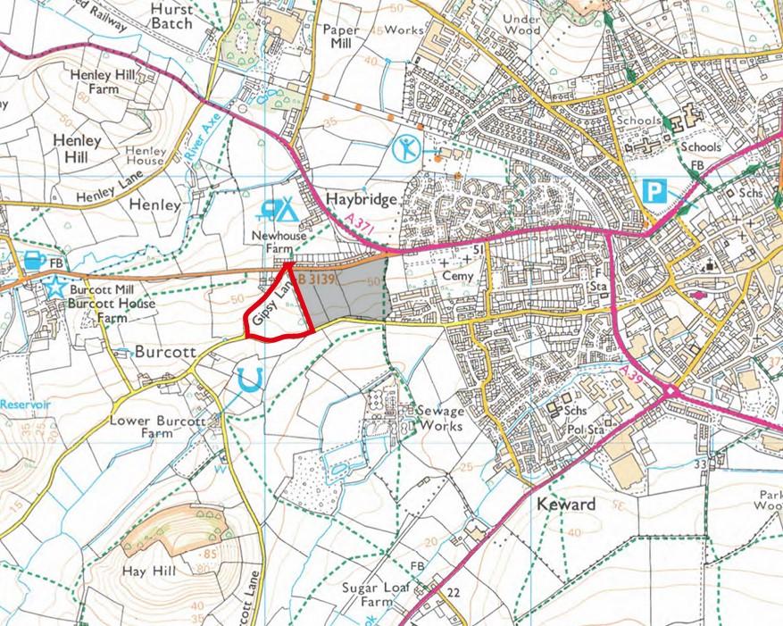
Location of the Site
The site is located on the western edge of Wells and is currently an agricultural field. It sits just south of the B3139 (Elm Close), one of the main routes in and out of the city. Gipsy Lane forms the site’s western boundary, while Burcott Lane runs along the southern edge.
The land immediately to the east is also currently in agricultural use. However, this neighbouring land has already been identified for housing in the Mendip Local Plan and has planning permission for 100 new homes.