Site Context and Planning Policy
Site Location and Surroundings
The site sits just off Lodge Causeway (B4048), close to the junction with Fishponds Road (A432). Vehicular access to the site is via a dedicated access road from Fishponds Road, with the vehicular exit being via Albert Terrace. There’s also pedestrian access at ground floor level and also from Lodge Causeway at upper level.
Fishponds Road is a busy local high street with shops, cafés and restaurants, and two large supermarkets are nearby. The area around the site is a mix of homes and larger commercial/industrial buildings. The Stapleton and Frome Valley Conservation Area is around 170 metres to the north, and the Bristol & Bath Railway Path runs a short distance to the south, providing a popular route into the city centre.
The Site Today
The site is on land to the north of Lodge Causeway and currently contains a long, two-storey building (around 46m x 15m). Built in the early 1980s, the building has a flat roof and is finished in dark red brick with light panels and blue-framed windows. A lift and entrance canopy have been added more recently at the southern end.
As Lodge Causeway rises onto a bridge nearby, the pavement along Lodge Causeway is around 3.5m higher than the site at ground level. The main entrance is at the lower level, with a secondary (mainly emergency) access at first-floor level directly onto Lodge Causeway.
There is a small area of outdoor space to the south-east, and most of the north-west part of the site is used for parking, typically by minibuses and adapted vehicles. The site is fenced and gated, and the gates are locked when the building is closed.
Nearby uses include Beacon Tower (a residential block) and offices at Lodge House to the north-west, Victorian terraced housing on Albert Terrace to the north, and a large commercial building to the south-east.
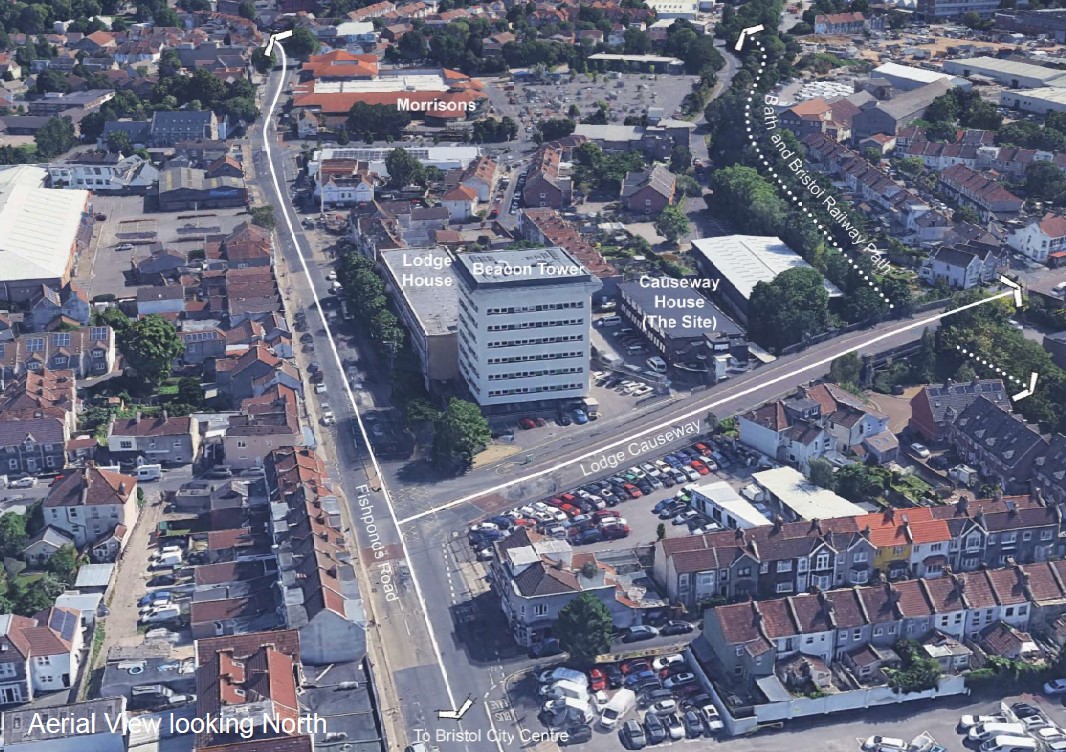
Aerial View Looking North
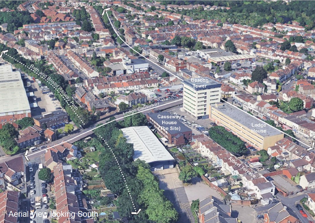
Aerial View Looking South
Planning Policy
The property is located within the Fishponds area of Bristol and within the administrative area of Bristol City Council. The development plan which sets out the policies against which planning applications are considered comprises the Bristol Core Strategy (June 2011) and also the Bristol Site Allocations and Development Management Plan (July 2014). It is these documents that guide what forms of development are acceptable within the city.
According to the core strategy, the site is located within a ‘local centre’. These are areas of the city which the council recognise as being highly sustainable, with good connectivity to services, amenities and public transport. Therefore, in these locations, the council is supportive of the principle of higher density forms of development.
On this basis, the site is considered to be a suitable location capable of accommodating student accommodation whilst safeguarding the existing use. It is not subject to any technical planning constraints, has good access to existing services and facilities, and would also present an opportunity for environmental improvements. It is therefore considered that the proposed development would accord with relevant local and national planning policy.