Highways
The location of a Site in relation to existing services and facilities is a key barometer of its sustainability credentials and whether it is capable of accommodating residential development.
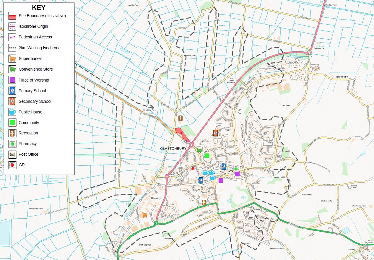
Guidance from the Institution of Highways and Transportation identifies 2km as the maximum suggested acceptable walking distance for pedestrians without a mobility impairment. This equates to a 25-minute walk. The adjacent figure shows all those services and facilities within a 2km walk from the Site. Given the close proximity of numerous services and facilities required for every day living, all of which are within walking distance of the Site, it is considered a sustainable location suitable for residential development.
The Site is also within walking distance of bus stops on Godney Road, which provide sustainanable modes of transport that connect the Site with services and facilities further afield.
Click above image to enlarge.
As the Site is bounded by the B3151 Northload Bridge to the south, it is proposed that vehicular access to the Site will be provided by the formation of a priority ‘give-way’ junction. This junction would be positioned approximately 67m west of the existing roundabout junction, which is formed of Northload Street, A39 and Northload Bridge. The Site access road would comprise a carriageway of 5.5m in width, supplemented with 2m footways to either side, joining to Northload Bridge with radii of 8.0m. Footways, of 2m in width, would be provided to either side of the proposed vehicular access, tying into the existing provision on Northload Bridge.
The preliminary junction design is shown in the image below. This design has been shared with Somerset County Council highway officers who have agreed its location and design principles.
